Hike the peaks of Simancón and El Reloj, enjoying panoramic views of the UNESCO biosphere reserve Parque Natural de La Sierra de Grazalema.
This blog is in loving Memory of Guy Hunter-Watts
View this post on Instagram
The name of Guy Hunter-Watts has become synonymous with walking escapades in Andalucía and beyond. It is with heavy hearts that we bid farewell to this beloved author, walking guide, and adventurer, who tragically died a few weeks ago in a biking accident near his hometown of Montecorto.
Guy Hunter-Watts, hailing from Bristol in the UK, found his true home in Spain—a place he affectionately called his “adopted country.” Over three decades ago, he ventured into the rugged embrace of the Ronda mountains, a region he would forever hold dear. Guy’s unwavering love for this land, its people, and its footpaths shaped his destiny and touched the lives of countless wanderers seeking to uncover the hidden treasures of Andalucía.
With the stroke of his pen, Guy wove stories that beckoned us to explore the breathtaking landscapes that we see around. His guidebooks, including the iconic “Walking in Andalucía,” “Coastal Walks in Andalucía,” and “Trekking the GR7,” became trusted companions for adventurers yearning to tread upon untrodden paths.
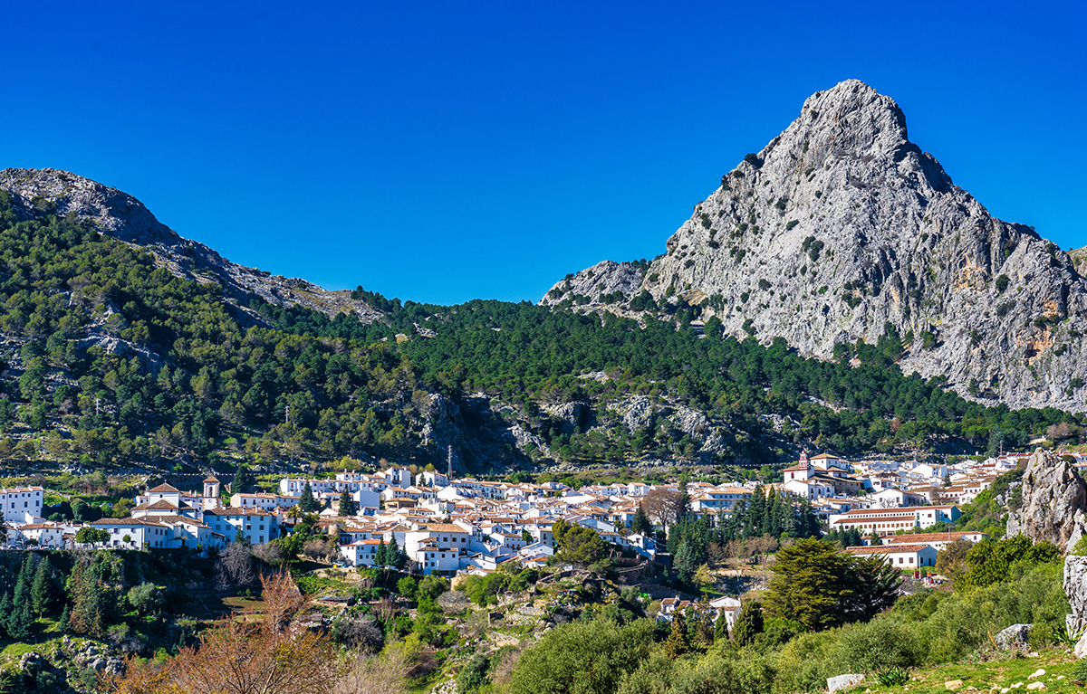
Climbing the Reloj and the Simancón in the Grazalema Natural Park
The Parque Natural de La Sierra de Grazalema lies just west of Ronda and straddles the provinces of Cádiz and Málaga. The park encompasses part of the most south-westerly mountain range in Europe, the tail-end of the Cordillera Bética. This rugged massif, predominantly composed of limestone and dolomite, rises steeply up from the rolling farmlands around Jérez to a height of nearly 1700m. The park’s terrain is extraordinarily varied; jagged formations of karst give way to poplar-lined valleys, thick stands of cork and evergreen oaks alternate with old groves of olives and almonds and with fields of wheat and barley.
The Park was recently declared a UNESCO biosphere reserve thanks in part to the diversity of its flora and fauna. The variety of wildflowers is extraordinary: a third of all the species that grow in Iberia are to be found within the Park. Spring is the most spectacular time of year – in late April and early May the flowers are at their best – but you see interesting botanical species throughout the year. And the Park is an ornithological wonderland with one of the major migratory roots between Europe and Africa running along its western fringe. Several species of raptors are resident: Booted, Short-toed, Bonelli’s and Golden eagles can be easily spotted whilst it’s not unusual to see a hundred or more griffon vultures on the wing.
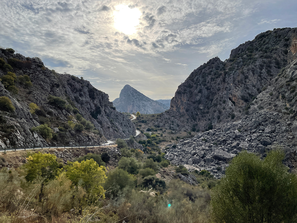
The villages of the Grazalema Park and those that lie just beyond are collectively known as Los Pueblos Blanco or The White Villages. They contain some of Spain’s most distinctive folk architecture with narrow streets of whitewashed houses with wrought iron rejas (window grilles) dropping steeply down the hillsides. The mountain perches of these villages are testimony to their having been built with defence in mind: this was the area of the last frontier or frontera between Moslem and Christian Spain. Grazalema, at the heart of the Park, numbers amongst the most beautiful of the white villages. Rural tourism is an important part of the local economy and the village now has four hotels, along with several bars and restaurants, in and around the main square.
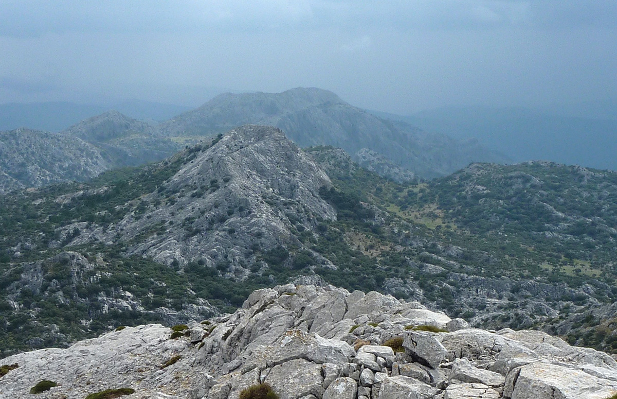
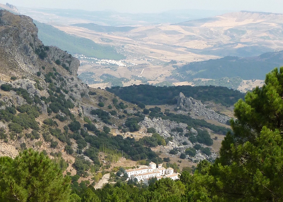
The challenging circuit described below leads straight out from the village and takes you to the top of two of the park’s highest peaks: Simancón (1561m) and El Reloj (1535m). After a steep climb from Grazalema village (at 800m), the forested lower slopes of the Sierra del Endrinal give way to a lunar-like landscape of weathered limestone peaks. Another steep climb brings you to the top of Simancón, from where, on clear days, you can see all the way to Morocco and the Atlantic Coast.
The path up and down El Reloj is a little trickier, but if you feel confident clambering over rocks you’ll have no problem finding the way up. Bear in mind that weather conditions change rapidly in the Grazalema massif, and that the ridge linking the two peaks is very exposed. You can cut out some climbing and shorten the walk by some twenty minutes by setting out from the car park next to the campsite at the top of the village.
The Nitty Gritty
Start/finish: Town hall, Plaza de España (Grazalema’s main square)
Distance: 12.5km
Ascent/Descent: 1050m
Grade: Medium/Difficult
Time: 4,5 hours
Refreshments: None en route, so take plenty of water
The Walk
From in front of the town hall, leave the village square by passing right of the Unicaja bank along Calle José María Jiménez. Bear left at the end of the street, then climb to the top of Calle Doctor Mateos Gago. Here turn left into Calle Portal then take the next right and head up Calle Nueva, passing a spring, to the top of the village. Here angle then turn right onto the Grazalema-El Bosque road.
After a few metres turn left into a car park and continue past the entrance to a campsite, to a signboard for El Complejo Subbético where you pick up a path to the left of a green metal gate. The path loops left then climbs steeply up between two fences. You shortly pass through a green metal gate and continue on up with the jagged ridge of Peñon Grande over to your right. After a steep climb through the pines the path levels then descends for about 50m to a wooden sign. Take the right-hand option, marked Llanos del Endrinal/Puerto del Boyar (35min).
The path descends, crosses a flat area between the pines then arcs right before reaching an enclosure surrounded by a stone wall topped by wooden posts, Los Llanos del Endrinal. Angle left and continue along the wall’s left side.
At the end of the enclosure, angling right, you come to a flat, open area. Here, cutting left then after 20m left again, you pick up a footpath that climbs steeply through the pines; it is overgrown in parts but easy to follow. Emerging above the tree line, the path cuts right before reaching a saddle (1hr 30min) from where you’ll see Simancón’s denuded massif to your left.
After angling left and running gently upwards, the indistinct path angles hard left then zigzags steeply uphill, with yellow arrows on a black background guiding you to the summit of Simancón (2hr 15min). At just over 1560m this is the highest point on the walk. To the east, connected to Simancón by a high ridge, you’ll see the summit of El Reloj.
Leaving the summit, drop steeply down the mountain’s rocky eastern flank to the saddle linking the two mountains. Follow the ridge along, just to its right, looking for cairns. At the eastern end, by a swathe of more open and grassy ground, angle left up to the summit of El Reloj (2hr 45min). From here, down in the valley floor to the south, you’ll spot a circular stone wall surrounding the well at Charca Verde – your next destination.
Leave the summit by following the ridge SSW for 100m to a cairn where you angle left then clamber down across the rocks, following more cairns. The path angles right, then left, to reach a flat, grassy area about the size of a tennis court. Here angle left and continue to descend to the valley floor and the walled well of Charca Verde (3hr 10min).
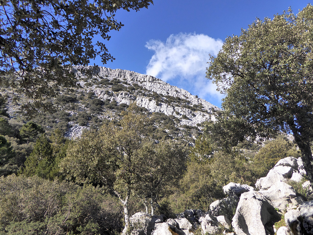
Bearing left around the well, pick up a path which after 30m reaches a junction. Here cut left. A black plastic pipe crosses the path then runs just to its right and ends at a small concrete trough. The path runs on, skirting round beneath Reloj’s rocky flank, passing a sink (a collapsed limestone cave) as it zigzags through low-growing oaks and pines. After running past a stone corral, it passes through to a rickety wire-and-post gate (3hr 45min). Eventually the path arcs down between huge rocks to reach a three-way junction. Here cut right, following a sign Grazalema 1.5km. After crossing a ridge, the path descends steeply back to the village campsite. Here cut left along the campsite’s fence to reach the path you followed earlier in the walk. Turn right, go through the green metal gate, and retrace your footsteps back to the square in Grazalema (4hr 25min).


